Saturday, December 12, 2009

Mattatuck Tr - Southern end

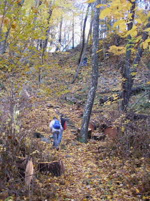
Louise and I decided to hike the southern most section of the Mattatuck Trail today. It was pretty cool (teens to twenties) and there were a couple of inches of crusty snow on the ground. The southern terminus is in Petersen Memorial Park in Wolcott.


Our plan was to hike to Wolcott Rd and then do the roadwalk back to the park.


The trail initially follows the Mad River and is very pretty. It looks like it also might be quite wet at times. Fortunately it was mostly frozen for us.


The trail eventually leaves the river, crosses a power line cut and then climbs up to an area that looks like it has views off the the right. However this turns out to just be the town transfer station. We had a nice lunch at the height of land before dropping down to Spindle Hill Rd (notice the stove, nice hot noodles for lunch, yum).


At Spindle Hill Rd Louise decided she'd had enough fun so she did the road walk back to the car and I continued on to Marino Pond.
The trail initially climbs back up to ridge and then cuts behind one of the local McMansions. It looks like it gets pretty wet in here too. Eventually the trail goes through a modest ravine which had some very nice icicles.


The trail then wrapped around to another cleft on which side was Indian Jack's cave (seen below)


From here the trail climbs to the ridge. There is a short side trail to a nice view. Not much to see today, but probably very pretty in the fall.


From the the trail trends mostly downhill to Marino Pond where Louise was waiting.


The hike was 3.6 miles with the side trail and took 2:45 including a relaxed lunch. Probably a bit slow due to the crunchy snow.

Friday, October 30, 2009

Hancock Brook and Whitestone Cliffs Trails

These two trails are located near the Jericho trail in Waterbury. There is a connector between the Cliffs trail and the Jericho trail.


The Hancock Brook trail starts off in a gravel quarry which is a bit off putting but quickly settles down into a woods road along Hancock Brook. It has been raining the last few days so the water was moving along pretty well.


There is a railroad line along the brook on the other side and some pretty impressive rock retaining walls were built to stabilize the slope. The line was quiet except for one truck riding the rails removing blow downs.


The trail stays pretty level just above the brook and at the base of a steep climb which was littered with rocks. Some interesting caves had formed in the talus.


Eventually the trail climbs steeply up a poorly stabilized slope (re-route due to owner issues?) and then returns on the ridge above the brook. There are a couple of nice lookouts up on top. Mostly looking across the gorge or south towards Waterbury.


The upper trail rejoins the lower just before returning to the quarry. Its listed at 2.8 miles and took me about an hour and a half.


The Whitestone Cliffs trail is right off of Rt 262. It has a pavilion near the start which might be related to the nearby Boy Scout camp. The trail follows woods roads until it begins to climb to the cliffs where it splits. I took the right hand branch (counterclockwise). After a scramble to an open ridge it drops down to a nice waterfall.


The trail then drops back down to a very soggy area that has had a lot of damage from ATVs. There was also a lot of trash, probably washed in from Rt 262. Eventually it winds back around past a large pool/swamp to another climb up onto a ridge.


At the top of the ridge is a nice open area with views. Unfortunately the views are of Rt 8 although the Naugatuck river is in the foreground. The view of the top itself is nicer.


A bit further along the ridge I found this wasp nest which was hanging at waist height. Luckily it had been abandoned for the season.


From there it is a steep slippery drop back down. Eventually you wind back around to the base of the cliffs the trail gets its name from.


From there it was only a short walk back to the trail jcn and then the parking area. Listed at 1.7 miles it took about an hour to walk.


Monday, October 26, 2009

CFPA Rock Workshop on the Metacomet Trail

The CFPA held its fall workshop in Penwood State Park . The workshop was to re-construct a set of stone steps on the Metacomet trail from the 1940s. A crew from the Ragged Mt preserve showed us how to use grip hoists to move very large pieces of rock.

We parked near Lake Louise which was very pretty with its fall colors.


From there it was a short walk to the bottom of the stone steps. A section of the trail had been "rediscovered" when a very large blowdown was removed (bottome right in the picture).

We set up a series of griphoists to move very large pieces of rock into place.


After a bunch of work we were left with this lovely staircase.


Sunday, October 4, 2009

Jericho Trail, Waterbury CT

We had a lot of rain yesterday but it was clear and the trees were changing so it looked like a good day to hike. There are a series of blue blazed trails in Waterbury and the Jericho is the longest at 3.4 miles. It runs mostly north south and is quite sporting with a number of steep climbs. It also has some nice ravines and caves. The only view on the trail is pretty closed in when the leaves are on the trees.


We parked near the southern terminus on Echo Lake road. The trail climbs steeply to the ridge and then runs along some cliffs with partial views south.

It then stays relatively level for a while crossing several wet areas which were over run by newts. On the way back it was frogs.


Shortly thereafter we began a descent into a rocky ravine. It was quite steep both going down and coming back up. On the way back up we traversed midway along a cliff face.


We continued to climb until we reached the high point, 810', where we stopped to cook up some noodles for lunch. There are views here in the winter, but not much to be seen now.
From there we dropped down into another ravine. There was a shelter cave near the top. Many of the rocks showed a lot of quartz with mica inclusions.


We then dropped down to Jericho brook and followed it west for a while. The trail crosses it at a point that is probably easy normally, but with all of the rain it was a bit tricky. The trail then follows woods roads through an area that burned in the 80s. Eventually we passed another large shelter cave and reached the end of the trail at a junction with the Mattatuck trail. It was obvious there was a nice view just a bit up that trail so we headed up. Nice open rock face with views north and east.
We returned the way we had come with only a slight detour when we missed the turn off of one of the woods road (you can see it on the track). This lead to a short bushwack and a tricky crossing of Jericho Brook. Otherwise the trip back was uneventful. The hike was about 6.8 miles and took us 4:20 including half and hour for lunch. It dumped rain on the drive home so we got quite lucky.

Sunday, August 23, 2009

Naugatuck Trail

We spotted a car at the route 42 parking area and drove around to the CPL near Andrasko road. The route looks like this in Google Earth:
Initially the trail goes on an old road along route 8, but after about 0.5 miles it turns into the woods and climbs up to the ridge. There we found the first of the letterboxes we were looking for (first of the Justice League series).

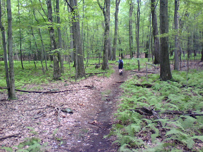
The forest was quite open and there were a lot of ferns.

Eventually we reached the turnoff for Spruce Knoll, which also had several letterboxes hidden nearby.

.
From here we continues along the ridge, often in open forest.
After finding several more letterboxes we took the side trip to Beacon Cap. This is an open area with a large glacial erratic. The only views we had were from the top of this rock. Once I was on top I discovered a large X marking this spot. No idea why.

From here it was a relatively short walk on to the route 42 parking area. The hike was about 6.1 miles all told and took about 4 hours. The pace was limited by finding a total 7 letterboxes.
The trail is in good shape, but except for the top of Beacon Cap there aren't any views.


Monday, November 24, 2008

Castle Crag


This weekend we hiked a portion of the Metacomet Trail in Meriden up to Castle Crag and West peak. We parked on the side of Route 71 where the trail crosses the road. After some initial confusion about who had the map, we headed up the hill to the west. At the top of the ridge we crossed the dam at the end of a small reservoir. The trail headed back into the woods where it became a road of ankle turning turning. Fortunately this didn't last too long and then we broke out onto the dam of a much larger reservoir. This one formed in a gap in the Hanging Hills with nice cliffs on both banks.


Shortly after crossing the dam we turned into the woods and began our climb up to the hanging hills. Eventually. First we had to cross a number of drainages which meant a lot of up and down. Finally we reached a very step pitch which did begin the climb up to the ridge. The trail climbed steeply at first and then more gradually. Eventually it swung east and hugged the cliffs overlooking the reservoir. Nice view of the island and a hawk circling below us.


The trail continues up along the cliffs until it reaches Castle Crag. Which is indeed a small crenelated tower. I had seen this for years while driving on I-691 and always wondered what it was. The tower was built by Walter Hubbard and donated to the town along with the 1800 acre Hubbard Park which surrounds it. It was a nice clear cold day so we had good views of LI sound, Hartford and up into Massachusetts from the top of the tower. Town workmen were hanging holiday lights and told us they would be closing off the tower later that day.


We continued to follow the Metacomet along the ridge. Eventually it rejoined the park road and became quite rough as the road took the good terrain.
Suddenly the trail turned away from the road and steeply downhill. This was a bit disappointing as we were obviously pretty close to west peak at this point.
After a steep rocky descent we reached an old woods road on a shelf below the cliffs. We followed this for no more than 50 feet when the trail diverged to the right and began to climb again. This climb was much more gradual and well graded. It wrapped around the west side of the summit and emerged through Cathole pass. The pass is pretty impressive which is why I imagine the trail goes this way. The trail eventually hits the parking area right near the summit. It would be a nice place with good views if it wasn't for all of the electronics towers. I hope nothing important got fried while wandered around looking for a view between the buildings, towers and trash.
From there we followed the park road back down to the reservoir. Much faster going although quite hard on the feet. From the reservoir we retraced our path to the car.
The 50 Hikes in CT lists it as 6.4 miles and it took us just under 4 hours. Nice hike although I might be tempted to skip West Peak in the future.

Monday, May 26, 2008

Pomperaug Trail

The Pomperaug trail is in Southbury and Oxford CT. It follows the east shore of Lake Zoar, mostly up on the ridgeline. The trail itself is only 4.6 miles long, but we split it up into two trips so we could explore some of the side trails as well.
In February we hiked the north end of the trail and returned on the Crest Trail. We parked near the entrance station for Kettletown State Park. It was a pretty nice day, and even though it was February, there were quite a few people around. There was almost no snow on the ground, only some hardpacked snow/ice in shady areas on the trail.
We started south on the park road and then turned off into the woods on the Pomperaug Trail. The hike is mostly in the woods on the west side of the ridge, so there's not much in the way of views. After a bit of walking we passed the north end of the crest trail. As it goes along the trail spent more time on the rocky ridge. Eventually we reached the southern junction with the Crest Trail. From here the Pomperaug trail descends to the Jackson Cove Recreation area. We continued on the Crest trail about 100 yards to an exposed area that had views of Lake Zoar through the trees. A nice place for lunch.
The Crest trail then turned 180° and headed back north. There were a number of ups and downs and then it dropped down to the state park camping area. Here we picked up the Brook trail. Not too surprisingly this follows a nice brook shown here.


We followed this trail back up to the park road and the car. The loop is about 3.9 miles and it took us just over 2 hours.
For the southern half of the trail we parked at Fiddlehead Road in Oxford. By now it was May and the trees had filled out quite a bit. But the biggest treat was that the wildflowers were out.


From the end of Fiddlehead Rd the trail climbs quickly to the ridge. There are a number of partial views of Lake Zoar along this stretch. This section also had most of the wildflowers including a Trillium:

A jack in the pulpit:


And a Lady Slipper orchid:


From the ridge the trail then drops steady down to the shore of the lake and the Jackson Cove Recreation Area. This was a pretty popular place with most folks using it to launch their boats. There were a few people on the beach. We had our lunch at the pavilion.


From the beach we continued north on the trail. It followed the shore of the lake for a bit, and then climbed up to the ridge where it met the intersection with the south end of the Crest Trail. We followed the Crest Tr a short way to the overlook we'd enjoyed on the trip in February. The trees now completely blocked the view of the lake!
We returned back to the beach. At the south end of the beach we picked up the Oxford Loop Tr. This follows the shore of the lake. Lots of unofficial picnic areas for the boaters along here. Eventually the trail climbs fairly steeply back up the ridge to the Pomperaug trail which we followed back to the car.
This section is about 5.7 miles as we did it and it took about three and a quarter hours to hike.